
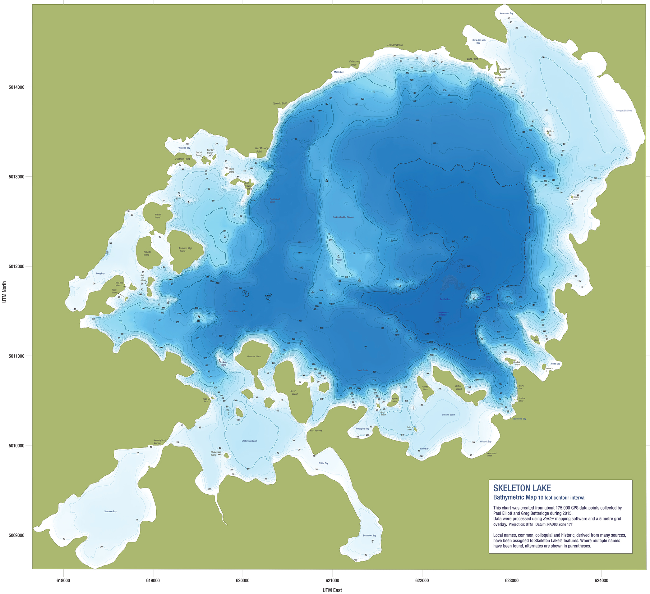
Skeleton Lake Bathymetric Map 10 foot contour interval This chart was created from about 175,000 GPS data points collected by Paul Elliot and Greg Betteridge in 2015. Data was processed using Surfer mapping software and a 5-meter grid overlay. Projection: UTM Datum: NAD23 Zone 17T Local names, common, colloquial and historic, derived from many sources, have been assigned to Skeleton Lake's features. Where multiple names have been found, alternates are shown in parentheses. |